Kostersundet
Marina near Långegärde
Latitude
58° 53’ 40.1” NLongitude
11° 0’ 52.8” EDescription
Fishing and sports boat harbor
NV Cruising Guide
Navigation
The fairway to the port is partially lighted and can also be navigated at night. However, those unfamiliar with the area should not enter in the dark. Coming from the northeast, leave Brattholmen on the port side and follow the deck bearing of 2 red lights at 251°. Once you are abeam Sydkoster's northern headland, follow the new deck bearing of 2 green lights at 223.5°.
From the southwest, you can enter through the narrow, lighted fairway with a water depth of 3 meters. Current sets in different directions, usually at less than 1 knot.
Berths
On the north side of the sound in front of a stern anchor at a sheltered guest bridge at a water depth of 2 - 7 m. You can also go alongside fishing boats by prior arrangement. Mooring at the large concrete quay is only permitted for short periods, e.g. to pick up provisions. Anchoring is not permitted in Kostersund from 1.06. to 31.08.
Surroundings
Nordkoster ist sehenswert. Aufgrund der milden Winter und den meisten Sonnentagen des Landes, hat sich hier eine eigene Flora entwickelt. Es wachsen z.B. zahlreiche Orchideenarten. Der nördliche Teil wird von einer Heidelandschaft geprägt. Große Teile, wie Sydkoster, sind Naturreservat. Es gibt viele Badeplätze und schöne Aussichtspunkte.
NV Land Guide
Nordkoster is worth seeing. Due to the mild winters and the most sunny days in the country, a unique flora has developed here. Numerous orchid species grow here, for example. The northern part is characterized by a heath landscape. Large parts, such as Sydkoster, are nature reserves. There are many bathing spots and beautiful viewpoints.
Marina Information
| Max Depth | 6 m |
Contact
| Phone | +46 731 525 939 |
| Please enable Javascript to read | |
| Website | https://www.nordkosterhamn.com |
Surroundings
Electricity
Toilet
Shower
Restaurant
Crane
Grocery
Garbage
Comments
You can add comments with the NV Charts App (Windows - iOS - Android - Mac OSX).
You can download the current version at nvcharts.com/app.
Buy nv charts covering this place Clicking one of the products will open the nv charts shop.
-
 NV Atlas Kartenkoffer Kattegat Serie 1, 2, 3, 5.1, 5.2 NV Verlag / NV Charts269,00 € incl. VAT, excl. Shipping
 -
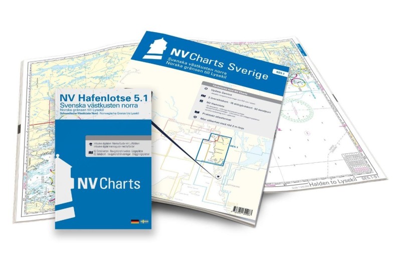 NV Charts Sverige SE 5.1 - Svenska Västkusten Norra NV Verlag / NV Charts69,90 € incl. VAT, excl. Shipping
 -
-

Places nearby

Related Regions
This location is included in the following regions of the BoatView harbour guide: