Havstenssund Süd
Marina near Havstenssund
Latitude
58° 45’ 15.9” NLongitude
11° 10’ 36.4” EDescription
Communal fishing and pleasure boat harbour with guest berths.
NV Cruising Guide
Navigation
The fairway to the harbour is lighted, so that it is possible to enter at night from both north and south. The western approach between Trossö and Märreklåvan is shallow and unlit, so this is only an option for smaller boats if you know your way around. When entering from the south it can be difficult to see the upper light. Note that the lower fire has a leading sector boundary (green-red) at 12°.
Berths
Longitudinally outside the floating bridge in the municipal guest harbour in the southern part of the Sound. The water depth is 3 - 8 m. Southerly and northerly winds can cause considerable swell, otherwise good to very good shelter depending on wind direction. Current sets in the Sound mostly northerly at a speed of less than 1 knot.
Surroundings
Havstenssund was once known as a trading centre for sea shellfish. Nowadays the place lives mostly from tourism. However, there are still some fishing boats. The surroundings are very beautiful on land and water.
Marina Information
| Max Depth | 5 m |
Contact
| Phone | +46 525 183 80 |
| Please enable Javascript to read | |
| Website | https://www.vastsverige.com/tanum |
Surroundings
Water
Toilet
Shower
Restaurant
Crane
Fuel
Grocery
Boatyard
Public Transport
Garbage
Comments
You can add comments with the NV Charts App (Windows - iOS - Android - Mac OSX).
You can download the current version at nvcharts.com/app.
Buy nv charts covering this place Clicking one of the products will open the nv charts shop.
-
 NV Atlas Kartenkoffer Kattegat Serie 1, 2, 3, 5.1, 5.2 NV Verlag / NV Charts269,00 € incl. VAT, excl. Shipping
 -
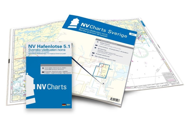 NV Charts Sverige SE 5.1 - Svenska Västkusten Norra NV Verlag / NV Charts69,90 € incl. VAT, excl. Shipping
 -
-

Places nearby

Related Regions
This location is included in the following regions of the BoatView harbour guide:
No comments or ratings have been added to this POI.