Flatskär Ulön
Marina near Hamburgsund
Latitude
58° 30’ 18.9” NLongitude
11° 15’ 58.7” EDescription
Natural harbour
NV Cruising Guide
Navigation
From the fairway, it is easiest to orient yourself along the northwest shore of Landlös Island. In front of the southeast corner of Dannemark, watch out for shallow water. You can also pass between the islands of Stora Flatskär and Landlös. However, extreme caution is required here because of the stones in the middle of the passage. It is best to pass the stones to the north.
Berths
You moor off the stern anchor or alongside the rock hooks of Stora Flatskär and Landlös marked on the map in 1-3 m water depth. There is good protection from waves in all winds except north to northeast. Protection from wind is almost non-existent. The bottom offers good grip, although existing seaweed may reduce it.
Surroundings
The islands are part of the Dannemarken Nature Reserve. Stora Flatskär is one of the most barren islands in the region, with many rocky areas and poor vegetation. The situation is impressive: you are sheltered and at the same time, just a few meters away, you have the Skagerrak in front of you. With a dinghy you can make interesting excursions in the shallow and sheltered waters. Dry toilets are available.
Marina Information
Contact
Comments
You can add comments with the NV Charts App (Windows - iOS - Android - Mac OSX).
You can download the current version at nvcharts.com/app.
Buy nv charts covering this place Clicking one of the products will open the nv charts shop.
-
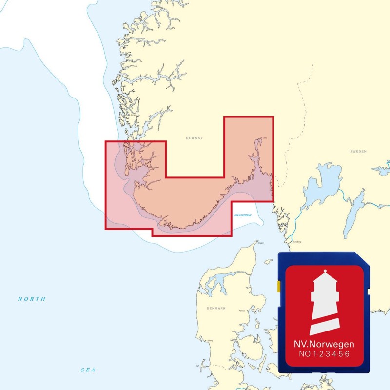
 NV Atlas Kartenkoffer Kattegat Serie 1, 2, 3, 5.1, 5.2 NV Verlag / NV Charts269,00 € incl. VAT, excl. Shipping
 -
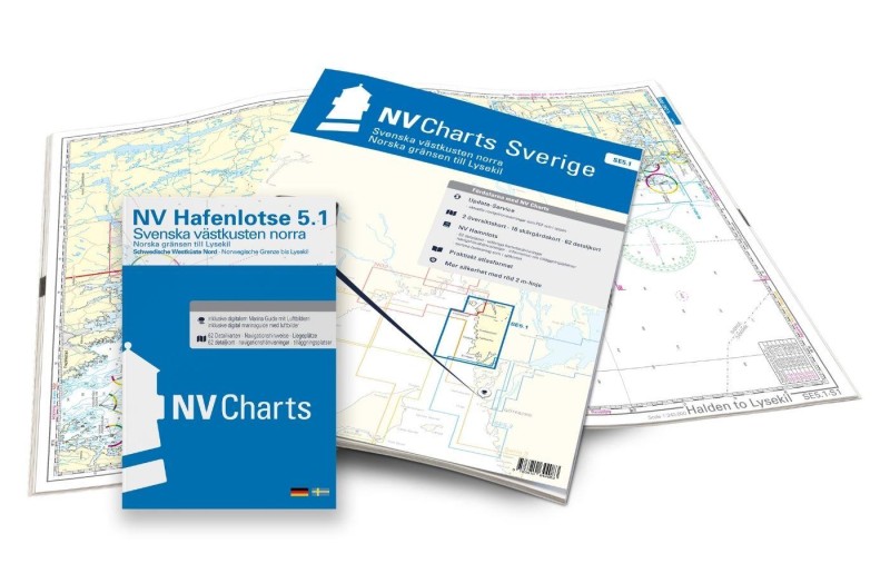 NV Charts Sverige SE 5.1 - Svenska Västkusten Norra NV Verlag / NV Charts69,90 € incl. VAT, excl. Shipping
 -
-

Places nearby

Related Regions
This location is included in the following regions of the BoatView harbour guide:
No comments or ratings have been added to this POI.