Dannemark
Marina near Hamburgsund
Latitude
58° 30’ 48.9” NLongitude
11° 15’ 52.7” EDescription
Natural harbour and anchorage.
NV Cruising Guide
Navigation
From the nearby fairway Sotekanalen - Hamburgsund the approach is easy. Note some stones under water near the shore at the western jetty of Dannemark.
Berths
You moor in front of stern anchors on the marked rock hooks on both sides of the bay between Dannemark and Ulön. Water depth 2.5 - 3.5 m with some shallower areas near the shore. There is very good shelter in winds from east over south to west. The bottom usually provides good anchor hold, but it can be affected by seaweed in places. Otherwise, you can anchor in 3 - 8 m water depth with a silty bottom throughout the bay. The buoys are private and may only be used by club members.
Surroundings
A nature reserve with a beautiful beach. From the hill you have a beautiful view over the island of Dannemark. Between Ulön and Dannemark is a fossil shell bank with interesting and rare flora. Good protection and the easy approach makes this natural harbour one of the most popular on the whole coast. Nevertheless, there is usually enough space for another boat. Three dry toilets are available.
Marina Information
Contact
Comments
You can add comments with the NV Charts App (Windows - iOS - Android - Mac OSX).
You can download the current version at nvcharts.com/app.
Buy nv charts covering this place Clicking one of the products will open the nv charts shop.
-
 NV Atlas Kartenkoffer Kattegat Serie 1, 2, 3, 5.1, 5.2 NV Verlag / NV Charts269,00 € incl. VAT, excl. Shipping
 -
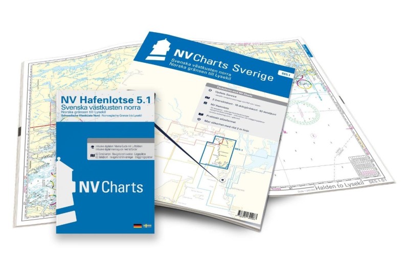 NV Charts Sverige SE 5.1 - Svenska Västkusten Norra NV Verlag / NV Charts69,90 € incl. VAT, excl. Shipping
 -
-

Places nearby

Related Regions
This location is included in the following regions of the BoatView harbour guide:
No comments or ratings have been added to this POI.